GAO renews satellite warning


 By
Frank Konkel
By
Frank Konkel
A possible gap in satellite weather coverage has warranted the topic's inclusion on GAO's high-risk list.

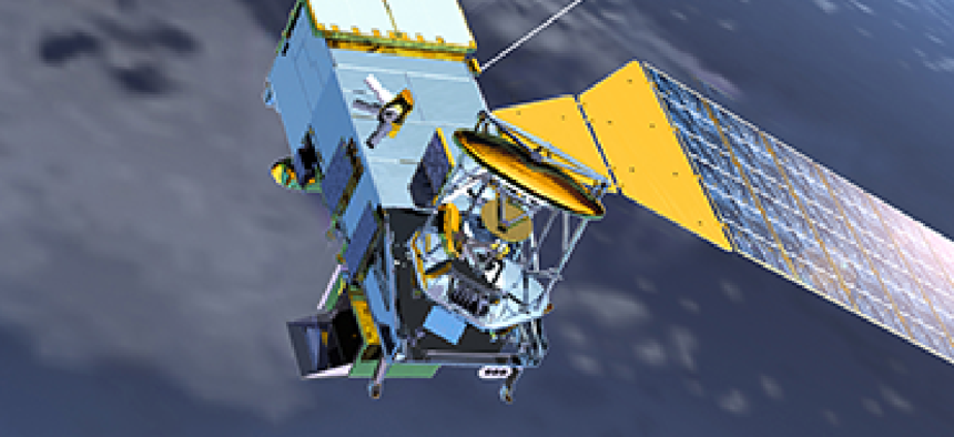
A looming gap in satellite coverage that could dangerously impair weather forecasts and advance storm warnings is now officially high risk, according to the Government Accountability Office. (NOAA image)
A looming gap in satellite coverage that could dangerously impair weather forecasts and advance storm warnings is now officially high risk, according to the Government Accountability Office.
The mitigation of potential gaps in satellite coverage was one of two new issues added to the agency’s biennial list of high-risk programs and topics, issued Feb. 14 by U.S. Comptroller General Gene Dodaro at a House Oversight and Government Reform Committee hearing.
"Right now, gaps in polar orbiting satellites that provide early, midday and afternoon warnings to feed computer weather prediction models and provide 3-, 4- and 7-day forecasts [could] occur as early as 2014, and could last up to 53 months," said Dodaro, testifying before the oversight committee.
Dodaro added that the European Centre for Medium Range Weather Forecasts concluded in a study that without information from polar orbiting satellites, meteorologists would have predicted Hurricane Sandy would turn out to sea, leaving coastal residents without a warning from one of the worst storms in history.
A gap in polar orbiting satellite data endangers "property and lives" and could have dire economic consequences, thus the addition to the High Risk List, Dodaro said.
While the National Oceanic and Atmospheric Administration (NOAA) has acted on previous GAO recommendations to produce mitigation plans, the High Risk Report states "these plans are only the beginning," suggesting congressional oversight is necessary to address the problem.
The news raised eyebrows among members of the Oversight committee, as did the inclusion of the federal government’s fiscal exposure to risks posed by climate change to the High Risk List.
Rep. Trey Gowdy (R-S.C.) shook his head at testimony offered by Dave Powner, director of IT management issues at the Government Accountability Office, on the gap in satellite coverage. Gowdy asked if the gap was truly likely, to which Powner replied, "There is a high-probability of a 17-month gap."
"Wow," Gowdy said, shaking his head again.
Why the potential gap?
Since the 1960s, scientists at NOAA, a scientific agency under the Commerce Department, have been using polar orbiting and geostationary satellites to observe the earth. Polar-orbiting satellites circle the Earth at low orbit in a north-south orbit much closer to the Earth’s surface than geostationary satellites, providing measurements like storm direction, speed and intensity, which is fed into data-driven forecast models.
For more than four decades, the United States has operated two operational polar-orbiting satellites – one by NOAA and the other by the Defense Meteorological Satellite Program, managed by the Air Force.
But those satellites have aged, and beginning in 2002, a joint program managed by the Department of Defense, NOAA and NASA called the National Polar-orbiting Operational Environmental Satellite System (NPOESS) was supposed to replace them.
But the program disbanded in 2010 after a series of schedule delays, ballooning costs and management problems, the High Risk Report states, and key responsibilities were transferred to individual agencies.
NOAA established the Joint Polar Satellite System (JPPS) program in response, but even with NASA assisting on it, a true replacement polar orbiting satellite will not be operational until at least 2017.
The program was able to launch and operate a converted demonstration satellite, originally called the NPOESS Preparatory Project (NPP), but its life expectancy is short because of "poor workmanship in the fabrication of the instruments," the report states. If it only lasts three years – which the report suggests is possible based on opinions by NASA engineers – the gap in satellite observations could be four years.
NOAA is exploring a few options to mitigate the issue. They include: maximizing the life of the NPP demonstration satellite; investigating how to speed up the development of the second JPPS satellite; and developing a plan to address potential data gap, which could include substitute satellite observations, non-satellite data, weather modeling and data assimilation improvements.
Those options all come with varying price tags, Powner said, and NOAA will have difficult decisions to make in the near future. The agency will have to decide whether and how to support legacy satellite systems, and how much time and resources to invest in improving satellite models so they can glean information from alternative sources. In addition, it will have to decide whether to seek international agreement to access additional satellite systems, and how these plans broadly play in sustaining weather forecasts for the future.
None of the options, Powner said, is likely to be as effective as simply relying on polar orbiting satellites. But it is necessary to think about them, he said, because soon the country may not have any polar orbiting satellites operational.
NEXT STORY: Interagency contracting no longer high risk