USGS draws FEMA a 3-D map


A U.S. Geological Survey mapping program will bring data and related mapping tools to bear on flood risk management and other hazards.
The Federal Emergency Management Agency is updating its flood-mapping capabilities and online services, backed by a newly funded program at the U.S. Geological Survey.
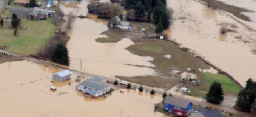
FEMA will be a prime beneficiary of the $13.1 million the White House injected into a 3-D mapping program as part of a larger climate resilience campaign. USGS officials said the program will bring data and related mapping tools to bear on managing flood risks, water resource planning, mitigating coastal erosion and storm surge impacts, and identifying landslide hazards.
Officials said enhanced elevation data could reduce the amount of time needed to update flood maps. The data could be a boon to customers of the National Flood Insurance Program by enabling faster delivery of updated mapping information to affected communities and individuals.
Major changes are also in store for FEMA's Map Service Center website, which is the official government distribution center for digital flood hazard mapping products for communities, the public and other FEMA stakeholders that manage flood risk. FEMA said the site provides a suite of user-friendly tools that support viewing, analyzing and printing flood hazard maps.
The MSC redesign is due to be completed by July 28. With the update, FEMA said, all flood hazard products will be free, and the agency's new tools catalog will have enhanced functionality. Old Web-based tools such as the MSC Store, Digital Post Office, Express Document Delivery and EDDie for Disasters tools will no longer be required to access the information.
The site will also include new address search functions that allow downloads of flood insurance rate maps and letters of map change directly from the search results page. New capabilities also include a search function by geographic area and automatic email notification of updated information by community, state, FEMA region or product type.
A measure enacted in March requires the development of more sophisticated floodplain maps so insurance rates can be accurately set. Floodplain maps also inform communities about flood risk and help set minimum standards for safer and more resilient building. FEMA said the older maps might not be suitable and plans to rework them.
NEXT STORY: Turning big data into better health outcomes