FAA partners with 3 companies to test real-world UAS uses


Agency also unveils the B4UFLY app, which is designed to help novice users fly their drones safely and legally.
The Federal Aviation Administration has moved to further expand and clarify its efforts to integrate unmanned aircraft into U.S. air space by partnering with companies to test the technology. The agency has also developed a mobile app aimed at schooling owners of small drones on how to safely and legally use them.
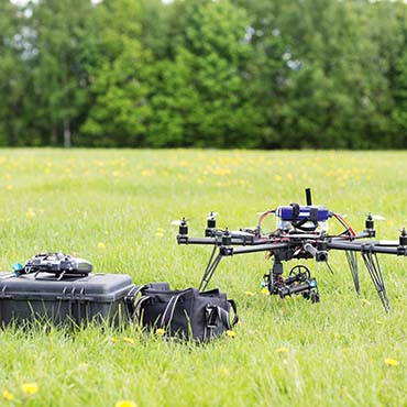
At the Association of Unmanned Vehicle Systems International (AUVSI) conference in Atlanta, FAA Administrator Michael Huerta said the agency would partner with CNN, drone-maker PrecisionHawk and BNSF Railroad to test small unmanned aerial systems (UAS) in practical applications.
The Pathfinder Program, Huerta said in speech at the show, will help the agency determine if and when it can safely expand unmanned aircraft operations. He said the three companies, which have committed their own resources for the program, "reached out to the FAA to work with us on exploring three key types of unmanned operations."
The FAA has been rolling out approvals for some commercial uses, including January approval of CNN's use of the aircraft for news gathering applications. But some private-sector users have complained the agency is moving too slowly. In March, Paul Misener, Amazon's vice president of global public policy, told a Senate Commerce, Science and Transportation Aviation Subcommittee hearing that his company abandoned plans to use one type of drone to test delivery service because its aircraft became obsolete in the time it took for the FAA to review and approve it.
In remarks at the AUVSI conference, Huerta said the Pathfinder Program companies would explore specific commercial uses of the aircraft with an eye for commercialization. CNN will research how visual line-of-sight operations might be used for newsgathering in urban areas. PrecisionHawk will survey crops in rural areas using unmanned aircraft flying outside of the pilot's direct vision. BNSF will explore using the vehicles to inspect rail infrastructure beyond visual line-of-sight in isolated areas.
Pathfinder will be carried out over a period of a few years, with the companies providing data that could fuel FAA approval of UAS operations for industry.
Filling the knowledge gap
Huerta also addressed spiking UAS use by ordinary citizens by unveiling a smartphone app, called "B4UFLY," that is designed to help novice model aircraft and UAS users know when and where it is safe and legal to fly their machines. New users unfamiliar with where and how to operate the aircraft can have substantial unintended consequences, he said.
"That's a knowledge gap we need to fill," he said. "The United States has the most complicated airspace in the world. We need to make sure hobbyists and modelers know where it's OK to fly and where it isn't okay to fly -- because there can be very real consequences if you don't. ... The incident on the White House lawn earlier this year is a good example."
The FAA's B4UFLY app, Huerta said, provides an easy-to-use way to determine whether there are any restrictions or requirements in effect at a given location. The FAA plans to release the app to approximately 1,000 beta testers later this summer.
The app has a "status" indicator that immediately informs operators about their current or planned location, as well as the parameters that drive the status indicator.
It also comes with a "Planner Mode" for future flights in different locations, interactive maps, contact information for nearby airports and links to regulatory information.
Brian Wynne, president and CEO of AUVSI, said the FAA's app dovetails with the Know Before You Fly educational campaign launched by his organization last December. The FAA is also a part of that program.
NEXT STORY: 6 questions to ask before any big data migration