FAA, FCC tackle hurricane complications


Unauthorized drones in the air over hurricane disaster zone and telecommunications outages are among the myriad issues facing response agencies as Hurricane Harvey churns through Texas.
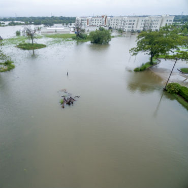
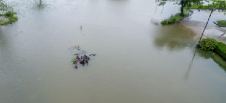
Flooding in League City, Texas in the wake of Hurricane Harvey. (Photo credit: Eric V. Overton/Shutterstock)
As disaster recovery efforts get underway in Texas coastal communities reeling from Hurricane Harvey's winds and rain, federal agencies are monitoring the airspace and tracking telecommunications outages in the stricken area.
The Federal Aviation Administration and Texas state officials tweeted out warnings as the storm pushed inland that airborne rescue teams in the area were encountering more than a few unauthorized drones that endangered their efforts.
Some people in the disaster zone near the hard-hit area of Corpus Christ are apparently using their commercial drone aircraft to get a bird’s eye view of the widespread damage inflicted by the storm over the weekend of Aug. 26 and 27.
According to the Texas Military Department, the small privately owned aircraft are threatening air rescue operations. The department tweeted out an alert Aug. 26 that its personnel in the area were "seeing civilian drones that pose EXTREME risks to our rescue pilots and crews in high need areas."
The department oversees the Texas Army National Guard, the Texas Air National Guard and the Texas State Guard.
The FAA had placed temporary flight restrictions in the area around Corpus Christi from Aug. 23 through Sept. 2. The Texas Military Department posted a map of the no-fly zones on its website and Twitter in hopes of keeping the unauthorized drone traffic down.
The drones were such a problem that the Federal Aviation Administration also tweeted a similar warning the same day that operators flying unauthorized drones in the disaster area would be subject to fines.
The FAA warned unauthorized operators they could face “significant fines” if they get in the way of emergency operations. It also said flying unauthorized drones in a disaster area could violate federal, state and local law, even if no official flight restrictions were in place.
"Allow first responders to save lives and property without interference," it said.
Meanwhile, the Federal Communications Commission has been tracking another critical resource during the storm -- the status of commercial telecommunications networks. The agency's Disaster Information Reporting System takes in outage data from telecommunications carriers during catastrophic events.
The Aug. 27 DIRS report said the number of outages for public safety answering points (PSAP) that handle 911 calls was climbing in the area, from nine on Aug. 26 to 17 on Aug. 27.
The DIRS report said carriers serving areas that took a direct hit from the storm -- Aransas, Calhoun, Refugio and San Patricio -- reported more than 50 percent of their cell sites down, with as much as 95 percent out in Aransas County, the bullseye of the storm’s landfall.
According to the report, 4.1 percent of the cell sites are down in the overall affected area of 55 counties stretching along the Gulf Coast from the eastern most tip of Louisiana to the southernmost tip of Texas .
NEXT STORY: The Hidden Features of the Samsung Galaxy Note 8